[SLOVENSKO]
:: latitude : N 45° 47' 45" :: longitude: E 14° 17' 35" :: altitude : 502 m ::
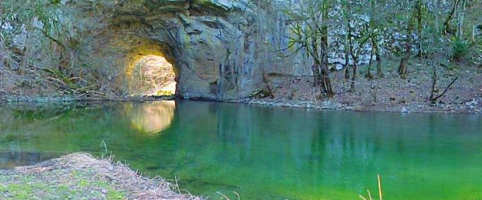
The Great natural stone bridge (old name of the bridge: "Velb") The stone bridge was formed more than 100 millions years ago. The height of the arch is 37 meters. On the top of natural stone bridge leads a macadam road. Photo sampling was on 19th September from 11 a.m. - 12 a.m. (#1, #2and #3) and on 20th September at 18:45 - [6:45 p.m.] (#4). The stream was dry so it was easy to stand below the bridge. The weather was sunny but fine because of light contrast between daylight 'on the surface' and on the bottom of the bridge - that is why the next day was a try with the evening shot. Check a virtual tour to that bridge when the riverbed was full of terrific stream: virtual tour from May 2003. |
||||||||
| Between the Cerknica polje (Cerknisko jezero - lake) and Planinsko polje is located the picturesque karst valley of Rakov Škocjan. The creation of this karst valley was the result of a junction of two types of valleys: 'the pocket valley' where the river has its source and the 'blind valley' where the river flows underground. In the upper part, the gable end of the valley there are the remnants of the tunnel, which is the Little natural bridge and about 2.5 km down the Rak River is the Great natural Bridge. The Rak River flows from Zelske jame (caves)... (as a fact from the sliplands) and continue its way to Tkalca Cave. The area of Rakov Škocjan was protected as Regional Park since 1949. The valley received its name from the church of St. Kancijan, which is abandoned, now in ruins. | ||||||||
|
18-22.September 2004 :: all rights of this site are reserved :: author: Boštjan Burger |