MojaSlovenija.si

English

POTOPISI / TRAVELOGUES

Boštjan Burger

Pyrenees

GR 10 long-distance hiking trail


Pyrenees

The Pyrenees are a mountain range in southwestern Europe. They stretch for 430 kilometers from the Bay of Biscay on the Atlantic Ocean in the west to the Mediterranean Sea in the east. The highest peak of the Pyrenees is Mount Aneto (Pico de Aneto, 3,404 m above sea level).

The Pyrenees are older than the Alps. The sediments that make up the Pyrenees began to be deposited in the Paleozoic and Mesozoic. The Pyrenees began to form about 100 million years ago during the collision of the Iberian microcontinent and the European plate. On the other hand, the Alps are part of the Alpine orogeny that occurred in the Cenozoic. The formation of the Alps began about 55 million years ago due to the collision between the African and Eurasian tectonic plates.

The Pyrenees separate the Iberian Peninsula from mainland Europe. Physically, the Pyrenees are divided into three sections: the Atlantic, Central and Eastern Pyrenees. They extend across three countries: Andorra, Spain and France.

In France, the Pyrenees chain crosses two administrative regions and six departments, from east to west: Occitanie (Pyrénées-orientales, Aude, Ariège, Haute-Garronne and Haute-Pyrénées) and Nouvelle-Aquitaine (Pyrénées-Atlantiques). On the Spanish side, it crosses four autonomous communities and seven provinces of Spain: Catalonia (Girona, Barcelona and Lérida), Aragon (Huesca and Zaragoza), Navarre and the Basque Country of Guipúzcoa).

Three national parks protect the exceptional biodiversity of the Pyrenees, which has several hundred endemic species: the Pyrenees National Park in France, the Aigüestorts and Lac Saint-Maurice National Park and the Ordesa and Mont-Perdu National Park in Spain.

The Pyrenees are crossed along their entire length by three high-altitude hiking trails, from the Atlantic Ocean to the Mediterranean Sea: the GR 10 on the French side, the GR 11 on the Spanish side, and the HRP, which runs high up on the peaks of the Pyrenees.

This virtual reality travelogue describes the experience of walking the GR10 (Le sentier de grande randonnée 10).


GR10

Early in the morning on Saturday, June 8, 2024, I flew from Ljubljana to Treviso airport with a Go Opti transfer, with a stopover in Brussels, and landed at Biarritz airport. I had to check in a 22-kilogram backpack containing all the necessary equipment for hiking in the mountains, camping safely, and of course photographing and documenting the landscape as oversized luggage on the plane. The Osprey Atmos 65 AG backpack was filled to the brim: a Robens Chaser 2 tent with theoretical resistance to wind gusts of up to 200 km/h, a RAB Neutrino Pro sleeping bag with a comfort temperature of -5C (I know, summer... but it later turned out to be a good decision), and a comfortable inflatable pad with a coefficient of R=5 (it is important to know that the sleeping system consists of a 50:50 sleeping bag and pad). My outfit was minimalist: two quick-drying RAB long-sleeved shirts, a short-sleeved merino shirt from Decathlon, three pairs of sports underwear, three pairs of hiking merino socks, a light Mac in a Sac down jacket and a waterproof RAB Kinetic 2 windbreaker. On top of that, I had a spare pair of hiking pants and waterproof rain pants.

In Biarritz, I was greeted by cloudy weather with a light drizzle. From the airport, I walked to the train station, 2 km away, where I quickly got a connection to Hendaye. At the airport, I was surprised by the ID check at the exit, and the heavily armed military patrols of young soldiers, almost children.

Originally, I had planned to buy a gas cartridge for the burner at Decathlon in Hendaye, and continue my journey from the beach in Hendaye to the first stage of the route. I also took some quick meals with me, as there weren't many options for buying compact food for long hikes along the way.

The rain intensified and a look at the weather app even announced a red alert for rain and storms. While riding the train towards Hendaye, I checked the options for accommodation via the Booking app and found a suitable guesthouse/'Gite', which was located 4 km outside Hendaye. The rain intensified and the walk from the train station to the accommodation made me feel discouraged. However, arriving at the 'gite' Amaia Baita put me in a good mood. It's interesting how some Basque words are semantically similar to Slovenian. The friendly owner met me at the guesthouse and I quickly realized that it was a BB guesthouse where the owner shares his house with guests. A beautifully decorated estate with surroundings and imaginative interior design of the house. The afternoon review of the latest weather forecast was not promising, as the forecast was confirmed with storms for the next day, Sunday, and even with the possibility of bad weather carrying over into Monday.

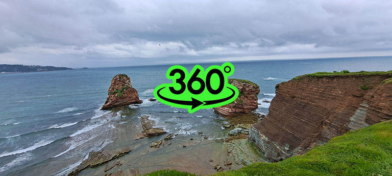
Sunday night was stormy with lightning and heavy thunder, and in the morning I woke up to a light drizzle outside. The coast east of Hendaye consists of cliffs and strong abrasion, so I decided to go for a walk to Hendaye despite the rainy weather and explore the coast.

The approximately six-kilometer coastal path to Hendaye was soaked from the night storms, and after about half an hour of walking, a strong wind and rain started to blow. The small, light folding umbrella lasted less than three seconds when I opened it, the wind literally crushed it and only the handle was left in my hands. The windbreaker did its job and despite the now heavy rain, I was not soaked. In Hendaye I threw the destroyed umbrella in the bin and in a moment of inspiration, since the whipping of raindrops in my face was unpleasant, I bought a large, strong umbrella, which, despite its weight, then accompanied me on my way.

Uvod v GR10


STAGE 1 (Hendaye > Olhette, 21 km)

Despite being a Sunday, the shops in Hendaye were open, which is very unusual for this part of France. Although I had planned to start the GR10 route only the following day, Monday, I decided to walk a few kilometers to the first major settlement after Hendaye on Sunday. It took me an hour to walk to Biratou, without a heavy backpack, of course, starting from the beach in Hendaye, past the old casino built at the end of the 19th century, where there are now restaurants and small souvenir shops, through the main street Boulevard du General Leclerc and then right to the Txingudi Bay, which separates the French Hendaye from the Spanish Irun. The Txingudi Bay is the estuary of the 66 km long Bidasoa River into the Bay of Biscay. The route follows a promenade along the bay and then heads south-east through the residential area of ​​Hendaye and gradually begins to rise towards Biratou. The GR10 route is well marked and you just have to follow the signs.

The path to Biriato was muddy and with puddles due to the previous heavy rain. The light rain turned into a heavy storm during the walk, so I turned around and headed for the pension-gite where I arrived muddy and already soaked on the first day, even though I was wearing 'waterproof' shoes. Only high rubber boots would have been able to handle a few hours of walking on heavy rain and muddy tracks and paths.

On Sunday evening I checked the weather forecast, which did not predict extreme weather conditions, but rain was predicted for the following week.

The hike had to start, so on Monday morning, on foot, fully loaded, I set off towards Hendaye, continued towards the Decathlon sports store, which did not open until 9 am, and there I bought a gas cartridge for the burner. Now fully loaded, I repeated Sunday's path towards Biriato. The morning drizzle turned into the morning sun, shining through the still dense clouds.

Unburdened by the rain, I devoted myself to observing the Basque rural architecture. Beautiful houses, all built in the same style with a white facade with built-in wooden beams painted a reddish brown color. There is no modern architecture here, as even the newly built houses are in the old 'historical' style.

At the village of Biratou, I caught up with my first hiking companions on the GR10. The father and daughter decided to walk the entire GR10 in two months. Pauline took her Samoyed dogs, whose white coats stood out against the green Basque landscape. The 28-year-old, 160 cm tall, bravely carried a 22-kilogram backpack with all her outdoor equipment and food for two dogs. The father, a 60-year-old who looked closer to 50, had grown tired of his career as a chef and had taken early retirement, deciding to enjoy life. Pauline, also a chef in the family restaurant, took two months off to think about “where to go next” and set off with her father on a journey from the Atlantic to the Mediterranean.

Monday. The first stage of the GR10 was accompanied by changeable, especially very "wet" weather, which was a constant in the following weeks of the hike. The first stage was also an introduction to the walking pace, which was "a little up" - "a little down". Psychologically exhausting for those carrying heavy backpacks.

The rain came in stormy waves from the direction of the Atlantic and the weather was literally changing from minute to minute. While walking, I like to think and devote myself to my thoughts, but I have nothing against conversations with 'fellow hikers' - when studying geography at university, I was impressed by the professor's idea during my first lectures that a geographer's powerful tool is precisely conversation with people in the field. I myself took the GR10 hike as a work project and not a sport or recreation, so of course I included this geographical tool - conversation. Although I have traveled a lot in France over the past thirty years, French is a "Spanish village" to me - I understand basic words and phrases, but I am not 'equipped' to converse. Unfortunately, most Frenchmen and women, interestingly also the younger generations and in the age of the internet, do not know how to use the 'universal language' today - English. Interestingly, in the later days I helped myself the most with Italian and German. Pauline, an interesting and, as I mentioned, brave girl, knew enough English for basic conversation, but my father, a man my age, was "only French", so my daughter patiently translated our conversations for him. We 'hit it off' well from the beginning, so we continued the journey together towards the end of the 21 km long first stage, which was in the village of Olhette.

Etapa 1

STAGE 2 (Olhette > Ainhoa, 21 km)

A new storm wave was approaching from the direction of the Atlantic, so we avoided the village and turned into a steep slope to the beginning of the second stage towards the village of Ainhoa. The wet and humid weather had already tired us, it was already late afternoon, so we were already looking for a suitable place to pitch the tent. The slope was steep and we were so sore on our knees that after about an hour of walking we reached a suitable level. The first raindrops had already caught up with us, so that the tents were pitched 'just a hair' ahead of the storm. The storm passed quickly and the setting sun broke through the clouds. Preparing dinner. Talking to Pauline about life, her translating for her father and then helping us into the tents... a new storm was approaching, which made us sleepy.

At night I was woken up by one of the Samoyeds, who was thirstily licking the tent. I looked at the clock and realized that it was actually morning, a little after six. In Slovenia, at this time of year, it is already daylight at six in the morning, but here the sunrise is delayed by more than an hour. At home, I get up before five in the morning, so I was already wide awake. I made myself a hot breakfast, packed up the tent, and since Pauline and her father were still sleeping, I quietly set off. I thought they would catch me on the way, because I was walking at a working pace, which means that I was recording the surroundings using the 360° spatial image method. I didn't think that Pauline and her father Maks would never see each other again...

I set off at sunrise, and from the direction of the sea, a new storm wave was approaching like a thick curtain, through which the morning sun shone and created a truly beautiful, fairy-tale rainbow.

The hillsides here are overgrown with ferns, where horses graze. There were many pregnant mares or mares with small foals along the footpath. Early morning and my first experience of foaling. Not far from the trail I saw a mare panting and then giving birth to a foal, which after a few minutes was walking around its mother.

The peak of La Rhune (905 m) peeked out of the fog and pointed the way towards the Col des-Trois Fontaines pass (563 m). A cogwheel railway leads to La Rhune, which is considered the first serious hill on the way from Hendaye from the valley. At the top, in addition to the communication tower, there are restaurants and souvenir shops, as La Rhune is a landmark of the Basque region. In good weather, there is a beautiful panoramic view of the Basque region from the top, from the high mountain peaks to the Atlantic Ocean.

I overcame the temptation to visit the summit when I climbed the pass, thick fog and light rain that intensified into heavy rain. Another wave of rain and then more drizzle, quite tiring for walking. After the Col des-Trois Fontaines, I crossed the cog railway and began to descend into the valley towards the village of Sare on a slippery and muddy path. In Sare, I had a snack and then set off on local roads and cart tracks towards the village of Ainhoa. The rain did not stop and even intensified. I found my way past numerous puddles on the cart tracks and avoided mud traps. The bad weather probably contributed to the fact that I did not meet any hikers that day, so I was surprised when a hiker caught up with me with a wide smile and a positive energy that radiated from afar. We continued our journey together and got involved in travel conversations. Vincent, as his name was, was from Biarritz and decided to walk the first half of the GR10 from Hendaye to Beguinage-de-Luchon. As a freelance industrial designer, he needed a break and took on the challenge of walking part of the GR10. He chose a completely different travel tactic. He booked accommodation in advance along the way, saving himself a few kilos of luggage. I found this tactic less relaxing, as I would have to walk at the exact pace according to the dates, regardless of the weather, or the accommodation reservation system would break down. I preferred to carry a tent with a sleeping system and a week's supply of food, and whenever I found a suitable place, I would pitch a tent.

Vincent knew Ainhoe, which was the end of the second stage, and even before arriving there he taught me about the history and importance of this village. Our conversation about the town began when, during the walk, I mentioned how good fruit yoghurt would be for me and how I would buy it in the shop in the village. Vincent smiled and said that Ainhoa, although it has more than 600 inhabitants, does not have a shop. Ainhoa ​​is an old settlement with written mention from the 13th century and still has a well-preserved town centre, which is now also ensured by regulations on dimensions with characteristic white facades and activities that are allowed. The 13th-century Church of the Assumption of the Virgin Mary is listed in the French Cultural Heritage Register, and the settlement itself is on the list of the most beautiful settlements in France.

Upon arrival in Ainhoa, the rain had subsided a bit. Vincent and I sat down in the summer garden of a restaurant in the centre and enjoyed refreshing fruit juices mixed with mineral water.

Etapa 2

STAGE 3 (Ainhoa > Bidarray, 21 km)

For Vincent, Ainhoe would be the final stop at the end of Tuesday's second stage, as he had already booked accommodation.

I, already tired, especially from the rain, continued on to the third stage and after about an hour of rather steep walking with a 250 m ascent along the Calvary, climbed above Ainhoe to the chapel of 'Our Lady of Aranzazu' (Notre-Dame-d'Aubépine) from the end of the 19th century. On the plateau where the chapel is located, there are three characteristic Calvary crosses, and nearby is an old cemetery with Hilarri tombstones. Hilarri (from the Basque hil 'dead' and harri 'stone') is the name for the disc-shaped tombstones typical of the Basque Country.

These tombstones represent a disc-shaped head facing the rising sun on a trapezoidal stand. They are part of an old tradition throughout the western Mediterranean, which includes parts of Europe and North Africa, but today they are found mainly in the Basque Country.

Before I reached the chapel, a heavy downpour overtook me, which turned into a storm, so I sought shelter in the chapel's vestibule. It was five in the afternoon, so I, now quite tired, thought about setting up a tent right here by the chapel. The ground was very wet due to the heavy rain, so setting up a tent was not an option for me. I took advantage of the calm during the storm to prepare a hot meal and decided to continue walking and find a more suitable place to spend the night.

The storm passed, the hot meal did me good, and I also rested enough to get a new impetus for walking. I studied the map for possible suitable locations to set up a tent along the path, saw that there would be quite a few of them after an hour of walking, and decided to continue the journey.

The path led me past a small old iron ore mine that operated here until the end of the 19th century, and then to open pastures where large flocks of sheep grazed. A new wave of rain caught up with me, so I came in handy with a large umbrella that I bought in Hendaye and now carry as a symbol of protection along the way. A palerina is the usual protection for hikers, but in the heavy rain that came in waves, the umbrella came in very handy. I could turn it against the direction of the rain, so that the annoying drops did not 'crash' in my face.

Following the path that turned into a cart track, I passed the flocks of sheep, and after two hours of walking I reached a ridge pass where the rain stopped. I quickly chose a place to pitch my tent, but I was caught in a storm again, so I pitched my tent in heavy rain. I inflated the mat, unfolded my sleeping bag, and fell into a tired sleep to the sound of raindrops.

I woke up to a cloudless morning with the sun rising, which lifted my spirits, as I was already in a rather bad mood due to Tuesday's rain. I prepared a hot breakfast and at seven in the morning I set off to continue the third stage. The morning turned into a sunny and very warm morning. There was high humidity in the air, so I quickly got soaked. I soon realized that I would run out of water, and the problem arose of where to get water. Large herds of sheep grazed on the surrounding hills, and here and there I crossed a stream, the water of which did not tempt me at all. I had a water filter and disinfectant tablets with me, which I only used when I reached the stream, for which I assessed that the terrain above it was unsuitable for grazing.

The continuation took place right next to the French-Spanish border, as indicated by the border stones. I arrived at the Cold des Veaux pass (550 m) where a steep asphalt road led to the Col de Mehatche pass (716 m). Small groups of mares with foals were grazing freely along the way and did not mind me when I approached them along the path. Just in case, as I did not want to risk being kicked, I dodged such groups in an arc. On the road, on a sunny and hot day, I was overtaken by a few cyclists who had chosen the Artzamendi peak (926 m) as their destination, where there is a communication tower. There are ancient menhirs with information boards along the pass, unfortunately only in French.

From the pass, the path began to slowly descend through the plateau world, and behind me I already felt the wind and saw a dark storm curtain, which was quickly approaching me. A beautiful sunny day turned in a few minutes first into thick clouds and then into very heavy rain. My umbrella saved me again, as hailstones were mixed in with the raindrops. I was exposed in the open air, so the umbrella offered me the only protection from the unpleasant hailstones. Just before the steep descent into the valley, there was a shelter for goats, who had gathered in front of the entrance from the hail, but it was closed. They bleated in panic, but I preferred to move away and wait for the storm to pass, as there was a steep descent into the valley ahead of me. The descent was along a rocky and rain-slick path, over scree and then over a precipitous bank.

When I left the steepest part of the path in the gully of the gorge, I suddenly stepped onto a narrow asphalted local road, which then meandered towards Bidarry along the Bastan river. The sun was shining brightly and the air suddenly became steamy hot. In the distance I heard the voices of a playful crowd and soon came to what appeared to be a local river swimming pool, where the exuberant, apparently schoolchildren from the local school were swimming on a sports day. Another hour of walking on asphalt and I had already arrived at the end of the third stage in Bidarry. I again hoped to buy fresh food in the shop or have lunch in a restaurant. Again unsuccessful. The French (Basques) strictly adhere to their divided working hours. At 2 pm I arrived in the ghost town, everything was closed, I could only supply myself with drinking water, which was available from the water taps in the public toilets. In a small park I started to prepare a warm meal when the sun suddenly turned into clouds and heavy raindrops began to fall. I retreated to the anteroom of the toilets, which also offered me a public shower, but I couldn't use it because I had to have tokens, which could be bought in the shop...

Etapa 3

STAGE 4 (Bidarray > Saint-Étienne-de-Baïgorry, 16 km)

In the only possible shelter in Bidarray, the toilet hall, I waited for the storm to calm down, but this time it was not over. After two hours of clearing, it was still raining heavily. In the meantime, I jumped to a small shop that opened at 4 pm. The rain was not over, so I changed into a cape, opened an umbrella and set off on the fourth stage. The start was from the settlement straight onto a steep and muddy path, which had already turned into a muddy stream that I waded up. I was sorry that I had set off too quickly, but I persisted and continued the climb. I was hit by hail again, then rain and more hail. I thought to myself, full of sarcasm of course… ideal!

After about an hour of climbing, the storm subsided and rays of sunlight peeked out from under the clouds. I had had enough of splashing around on the muddy path, so I decided to find a suitable place to set up my tent. The hill was steep and there was no sign of any leveling, but then a mountain saddle appeared around the bend between two hills, where there was a smaller leveling. I pitched my tent. Nearby was the rocky peak of a smaller hill to which the path led. After pitching my tent, I followed it curiously and came to the spodmolovi, where something must have happened in the past, either they provided shelter for shepherds or even had some religious significance, as the surrounding rocks reminded me of erected megaliths.

I slept like a dead man and woke up to the sunrise in the morning. The morning was cloudless and the day started promisingly. I didn't prepare breakfast, as I had planned to have it higher up in a more scenic location. And the views that day were magnificent. Beautiful sunny weather and viewpoints along the long ridge. I diligently documented the route with 360° spatial images, and then after two hours of walking just below the Pic d'Iparia (1044 m) I treated myself to a hot meal. This was also the first thousand-meter summit I conquered on the way from Hendaye. Here, after Vincent and I parted ways in Aihon, only he caught up with me. Because I was taking advantage of the good weather and beautiful views to document the landscape, I was too slow for Vincent, so he rushed ahead with a much lighter backpack. This, the fourth stage between Bidarray and Saint-Etienne-de-Baigorry was relatively long, only 16 kilometers, but according to the information on the length of the walk without stopping, it took a good six hours, and realistically, considering the given timeline, I had to add at least half the time to it. I was warned that access to drinking water would be very limited on this stage, so after I had used up three liters and was not even halfway there, I started looking for possible springs. I had my first chance to fill my bottles only after descending from Buztanzelhay Mountain (1029 m), when I crossed the Col de Buztanzelhay saddle and started descending into the valley. Due to the heavy rain in the previous days, there were many small springs just below the saddle, which merged into a stream. I filled the bottles and threw disinfectant tablets into them. The day was getting hotter and hotter, and when I arrived in Saint-Etienne de-Baigorry after two hours of walking, the temperature was already 32 C° and my water bottles were empty again. The previous days had been cold, so the sudden rise in temperature was quite tiring for walking. In the center of the village there was an open guesthouse, where I was met by hikers I had met on the trail the previous days. The hot day made us lazy and most of us decided to end our walk for the day. North of the village is a nicely arranged campsite, where I washed and dried my muddy and soaked clothes from the previous days. The first warm shower after four days of walking from Hendaye is also a good thing.

The day turned into a warm evening. The Englishman Denis pitched his tent nearby. The man was about my age and had already hiked the Spanish side of the Pyrenees on the GR11 in previous years, and now he decided to hike the French side as well. Evening English-Slovenian chatter about hiking experiences and then falling into a tired sleep.

Etapa 4

STAGE 5 (Saint-Étienne-de-Baïgorry > Saint-Jean-Pied-de-Port, 20 km)

Still in the dark, at six in the morning, after packing my tent and having breakfast, I set off from Saint-Etienne de Baigorry in the south direction. While still in the village, I crossed the Nive des Aldudes river over a bridge and climbed the steep slope of the Oilarandol hill (933 m). I caught up with a hiker, a Frenchman named Mario, who was walking at about the same pace as me. Along the way, I documented the landscape with spatial images, while Mario was interested in orchids and stopped and enthusiastically photographed them. I don't know anything about orchids myself, I only know that they occasionally land at our house as a gift and decorate the house for a few weeks until they bloom... I definitely found it interesting to observe and talk to a man about orchids who spoke about them with such passion.

Another stable day with stable weather, which means that I wasn't drenched from the rain, but it was very muggy, so my 'guts were running'. I quickly ran out of water, but there were strong fresh water springs along the way, but because of the higher pastures I didn't want to risk it and used chlorine disinfectant tablets. All well and good, but such chlorinated water is disgusting to drink, so I enriched it with a bag of orange-flavored magnesium, and then I forced myself to drink it...

The path along the contour lines of the fern-covered slopes around Oilarandol was picturesque and easy, practically flat walking, so I no longer felt the heavy backpack as a burden and by the fifth day on the trail I was already used to carrying it. After two hours of walking, Mario and I cooked lunch on the Col d' Urdanzia pass (869 m). Mario discovered new orchids, and I continued on to Mount Munhua (1021 m), where Vincent caught up with me with light feet. He praised me for being so fast, as he expected him to catch up with me much earlier.

From Mount Munhua, the path led downhill towards the end of the fifth stage, Saint-Jean-Pied de Port, so I successfully followed Vincent and documented the route as I went. Along the way, Vincent explained to me the history of the town, which was our daily destination.

Saint-Jean-Pied-de-Port, or Donibane Garazi in Basque, is also the old capital of the traditional Basque province of Lower Navarre. Saint-Jean-Pied-De-Port is also the starting point for the French part of the famous Camino de Santiago pilgrimage route. The town lies on the Nive River, 8 km from the Spanish border, and is today the capital of the Basse-Navarre region. In 2016, the town was ranked among the most beautiful villages in France. The old town itself is essentially one main street with numerous souvenir shops related to the Camino, pilgrim accommodations, and restaurants.

When Vincent and I arrived in town, a storm was approaching, so we each went to our own lodgings, and decided to have a good Basque dinner in one of the restaurants in the evening.

Vincent had a room booked in a guesthouse, while I went to the nearby 'municipal' campsite, where I quickly set up my tent and took a long hot shower. The advantage of carrying an umbrella was that I could walk through the town in the rain and explore its attractions. Saint-Jean-Pied-De-Port is a peaceful town, and despite the many travelers, of course the vast majority of them pilgrims, the atmosphere was relaxed.

I set off on my journey with very little cash, as I was counting on paying with a credit card. The problem is that in the Basque Country, or at least on the route I was walking, most guesthouses and shops did not accept credit cards (why pay a fee to the banks?) or limited their use to amounts over fifteen euros. This was also the case in Saint-Jean-Pied-De-Port. I started to worry about how I would be able to pay, if such a large settlement along the route did not allow convenient payment with credit cards, so I tried to find an ATM, which was again a real treasure hunt. Using ATMs is not as straightforward as it is here in Slovenia, but you can withdraw cash from a bank with an appropriate fee, but of course the bank must be open...

Towards evening, Vincent called me and told me that he had found a good restaurant where we could enjoy Basque food. And it really was... in front of me was a large, double oval plate with roasted meat cut into thin slices, I'm not exaggerating when I write that the portion was a kilogram. Then a vegetable side dish, fries... in short, everything a person wants after five days of dehydrated meals. I usually don't eat meat and I'm practically a vegetarian, but when I'm on the road I know that I need protein, and then I go beyond principles and eat the protein that is available.

Our dinner was long, in the meantime a pretty bad storm with strong wind raged outside and I was starting to worry a little if the tent I had pitched would be waiting for me in good condition. Talking about life, thinking about the route along the GR10, where to go next... time passed and it was dark outside. We said goodbye and each went to our own accommodation. My tent was intact with a dry interior, so I just brushed my teeth and literally collapsed into my cozy, fluffy sleeping bag, it was getting cold.

Etapa 5

STAGE 6 (Saint-Jean-Pied-de-Port > Kaskoleta, 17 km)

At dusk, I crossed the city walls from the city fortress and left the pilgrimage center of Saint-Jean-Pied de Port. I continued my hike in a southeasterly direction along the local asphalt road towards the village of Caro. Below, lower in the valley, morning fog was hanging, and the morning sky was covered with thick clouds. The humidity was 100%, so I was already sweating and drenched from a light drizzle at the very beginning of the path.

On the road, I caught up with Ron, a hiker from Alsace who, in addition to French, only knew German. We continued our conversation in German and followed the GR10 signposts. The village of Caro was a typical Basque village with white facades and characteristic stone corners between the sides of the houses. Like every, literally every Basque village, there was a Basque pelota court set up in the village, which is similar to squash. The court with its high U-shaped walls, which provide a rebounding surface for the ball, is hard to miss. However, many pelotas are played on courts with only one or two walls.

Basque pelota is the name for various games on a court, played with the ball by hand, racket, wooden stick or basket, against a wall (frontis or fronton) or, more traditionally, with two teams facing each other, separated by a line on the ground or a net. The roots of this class of games can be traced back to Greek and other ancient cultures. The term pelota probably comes from the Vulgar Latin term pilotta (ball game). It is a diminutive of the word pila, which may refer to a hard linen or leather ball filled with pilus (fur or hair) or to the Latin words for a blow or a spike and is related to the English word pellet.

Pelota is commonly played in the Basque regions of southwestern France and northwestern Spain, where it originated. Basque associations also exist in Argentina, Bolivia, Brazil, Canada, Costa Rica, Cuba, Chile, the Dominican Republic, Ecuador, El Salvador, the Philippines, Guatemala, Italy, Mexico, Paraguay, Peru, Uruguay, the United States (including Puerto Rico), Venezuela, the Netherlands, Sweden, India, and Greece. Because of the game's origins, there are many good players who are Basque, either natives or from the Basque diaspora.

From Caro, the journey continued through the rugged, hilly Basque countryside. The journey would have been very pleasant if it hadn't been for the high cloud cover, humidity, and occasional drizzle.

Near Mount Gattare (761 m), I first came across a fenced and landscaped carrion farm intended for griffon vultures. The griffon vulture (Gyps fulvus) is a bird of prey from the crow family. It is a scavenger, and like other vultures it feeds mainly on the carcasses of dead animals. It spends most of its time gliding on its large wings; its flight is clumsy, so it spends most of its time gliding in the air. On the ground it is found in the open, tracking or walking; it takes off and lands on the ground or in trees.

The size of the griffon vulture is 95–110 cm with a wingspan of 230–265 cm, an individual bird weighs 6 to 10 kg, in appearance it is a typical hawk with a white head, with very wide wings and a short tail. A small head, which, unlike the brown hawk, is covered with white down. The bird is sociable and lives in colonies of up to two hundred birds. Theoretically, the bird is not large, but when it flies over a hiker, it feels like a glider flying over. A few stages later, I myself experienced in the wilderness what it looks like a colony of a few dozen birds snatching a cow that had died from a lightning strike in a recent storm and collecting it in about half an hour.

As I already mentioned, the GR10 route is well marked and for the most part I followed the signposts and signs with the word GR10 without worry. The marked route has changed over time, with new sections added or variations added between individual stages. I had a printed map with me, which I didn't use much because of the rain, and the digital Komoot application with a set route with the option of audio guidance. The old route led west of the Gattare hill, but the new one was extended east by three kilometers and went up the hill along the way with better views and between natural rocks carved into the slopes like natural megaliths. Along the way, pastures with horses accompanied me and suddenly I realized that I was completely alone in the middle of the 'wilderness'. Ron had already been left behind for kilometers, and I strangely did not meet any other hikers that day. I follow the GR10 signposts and around one in the afternoon I get hungry, so I prepare lunch on the slope by the natural megalith and rest. I check my digital map and find that the saved route is a few kilometers west of my current location. It immediately dawned on me that this was a new, added route. I had already wondered to myself that it was so poorly walked despite the markings.

A steep descent followed to the village of Estérençuby. Estérençuby lies at an altitude of 219 m along the D301 road and the Errobe (La Nive) river. The climbs were not a problem for me, but the descents were a demoralizing experience, as I knew that a steep descent is usually followed by a steep climb. In the village, before climbing again, I reached an open tavern, where I was surprised by familiar hikers from the previous days. Among them was Vincent, who explained that they had all chosen a shorter route, which had saved them about two hours of walking.

After a rest, three of us from the group headed towards the end of the sixth stage, the Kaskoleta mountain refuge, while the rest decided to break off the hike due to the forecasted, even worse weather.

This was followed by an almost two-hour, five-hundred-meter climb along a local winding road, which led us past numerous pastures with sheep farms to the Kaskoleta shelter or hut.

Due to the gloomy, cloudy weather and numerous climbs and descents, I was already quite tired that day, despite only six hours of walking from Saint-Jean-Pied de Port. However, the free beds in the hut were already taken, I prefer to camp in the wilderness and, last but not least, it was only three in the afternoon, so I said goodbye to Vincent and continued on my way to the seventh stage towards the Chaletd d'Iraty recreation center.

Etapa 6

STAGE 7 (Kaskoleta > Chalets d'Iraty, 20 km)

From Kaskoleta I started the seventh stage at three in the afternoon. The sun peeked through the clouds, filling me with energy. The path was steep and I didn't even notice the hundred-meter difference in altitude from Kaskoleta to the Cold de Ithurramburu pass (808 m). After the pass, the path started down the cart track into the gabled valley of the Intzarazkiko Erreka river. Does the name sound familiar? Slovenian "reka", Basque "erreka".

The cart track went down and down... steeply, but when it dropped 200 m above sea level, after an hour of walking I had covered quite a few kilometers until I reached the river, now more of a stream, next to which was an abandoned mill. There followed a sharp bend and another kilometer or so, now steeply uphill, when I reached a small clearing with a tent pitched where Alsatian Ron was waiting for me. He overtook me right where I had made a turn before Estérençuby, and he had taken the old shortcut.

There was barely enough room in the clearing for one tent, the gorge was quite narrow, and I prefer to pitch my tent in nicer vantage points, so I decided to continue, even though the path led up a narrow and very steep path towards the Col d'Irau pass (1008 m). I gained four hundred meters of altitude to the pass and started looking around for suitable places to pitch my tent. In front of me rose Mount Iraukotuturru (1151 m), whose peak was now only 150 m higher than me. Sunset was approaching, so I climbed below the peak, where I found a safe viewing platform and pitched my tent.

The place was 'mystical', picturesque rocks, views, sunset...

A rather strong wind started to blow, which I took advantage of to dry the tent, which I had been carrying still wet from the stormy night in Saint-Jean-Pied de Port. I prepared a hearty dinner and lazily settled in the shelter between the tent and a large rock, observing the landscape below in the valley.

Although the wind was blowing relatively strongly, I slept safely and peacefully until morning and missed the sunrise. I was in no hurry, a nice day was predicted ahead of me before a period of bad weather with orange and red storm alerts. After breakfast, I packed the tent, prepared for orientation and walked along the long ridge of the pass, almost flat, to the foot of the Sommet d' Ocabe mountain (1466 m). Since the morning was beautiful, I eagerly documented the route, which slowed down my walking. Ron caught up with me, along with another French traveler, Mark. All three of us were about the same generation, "almost" sixty years old...the conversation was in German and my useless French,... anyway, the important thing was that we understood each other. I learned that Ron was a retired police officer, and Mark was a retired professional soldier from the lineage of rapid action paratroopers. As a war veteran and twenty years of history in military police units, I also had some kind of "pedigree" of this kind, so we quickly found a common language and by the way we climbed the Sommet d' Ocabe.

Below the summit are visible stone circles erected 4000-5000 years ago, known as the Cromlech d'Ocabe. These are stone circles that served as burial grounds for important ancestors of the Basques.

The first description of the magnificent series of protohistoric tombs erected on the Occabé plateau dates back to 1914. René Gombault was the author of the first excavations on two monuments, the results of which were not published until 1935. With these excavations, which continued in 1968-1969, the total number of monuments was 26. They are located in the heart of the Irati region, in the heart of the mountain ranges of the Basque Country. The vast pastures of the Occabé plateau occupy an absolutely privileged position at the center of an extensive network of ancient routes dedicated to the migration of animals. The archaeological complex, of which Occabé is at the center, includes an impressive number of 10 dolmens, 63 burial mounds, 107 *cromlechs and 232 remains of hut plans.

*Cromlech (Breton: crom llech = "bent stone slab"; ) is a prehistoric megalithic structure made of megaliths placed in irregular circles or ellipses (stone circles), which had ceremonial and religious significance in the Neolithic or were part of larger structures, such as stone mounds with burial passages.

The ancestors of the Bretons knew well where to place their sacred places: usually places with beautiful panoramas... and indeed, when I walked among the stone circles I felt some inexplicable "ancientness".

The path from the plateau world of Occabe descended steeply into a dense beech forest, which in this area is considered the largest and most beautiful forest in the Pyrenees. Literature even claims that the Iraty beech forest is even the largest beech forest in Europe.

A quick descent along a winding forest track and within an hour Ron and Marko reached the local asphalt road and then two hundred meters to the mountain guesthouse Chalet Pedro, tucked away in the forest. We treated ourselves to a cold beer and large sandwiches with boiled ham. Since there were few opportunities to get drinking water, we each stocked up with a few liters of water. I need about half a liter of water per hour of walking, so I always carry at least three liters in reserve, which is noticeable with the additional weight of the load in my backpack. From the guesthouse, we set off on the D19 road, about two kilometers through the picturesque valley of the Urbeltza river, which, given the numerous parking lots for campers, is a popular recreational area for trips to the surrounding hills. In front of the Chalet d'Iratty guesthouse along the D19 road, we turned onto a narrow path that was a shortcut to the damming of the Lac d'Irraty river. A shortcut only in terms of distance, but in reality the route was longer in terms of time, with a steep climb and then a descent to the reservoir. After the lake, the climb continued to the mountain recreation center Chalet's d'Iraty, where stage 7 ended.

The Chalets d'Iraty were built in 1966. This project was part of a wider effort to develop the region for both pastoral and tourist purposes. The Chalets d'Iraty have become a popular destination in the Basque mountains, offering a unique combination of natural beauty and cultural heritage

Ron and Mark had enough walking for the day, so they decided to spend the night at a nearby campsite, while I continued on to stage 8, towards Logibar. It was barely three in the afternoon, so I decided to continue until dark and then pitch a tent somewhere along the way.

Etapa 7

STAGE 8 (Chalets d'Iraty > Logibar, 17 km)

From Chalets d’Iratya to Logibar it was 17 km or 5 hours of walking, mostly downhill, I still had enough energy but a look at the map showed me that Logibar was just a roadside inn in a narrow gorge, so I decided to walk to the first suitable place with a view and pitch my tent there.

On the edge of Iratya is the mountain pass Col Bagargiak (1327 m), where the road to the east splits into a narrow northern and a busier southern section. I follow north along a narrow asphalt road occasionally visited by motorcyclists – apparently the panoramic road is popular with motorcyclists, which I had noticed earlier in the Iratayua tourist center. During my rest there quite a few groups of motorcyclists stopped there, interestingly, mainly German ones.

The road wound around the southern slope of Athanolatzegagnie (1530 m) and Pic des Escaliers (1472). I initially intended to climb the route over both peaks, but threatening storm clouds began to approach from the east, so I decided to bypass the peaks and get as close as possible to Longibár in the east. The surrounding slopes were pastures where herds of cows grazed. Although on the slopes the grassy ground was swampy and fertilized with numerous cowsheds where flies were grazing. I had no desire to pitch a tent, so in the rather sultry atmosphere and with a possible storm behind me I sped along the narrow and muddy path that led along an almost flat contour line south under Mount Beloscare (1173 m). The clouds caught up with me, but fortunately they did not bring any rain. I came across a levelling area, which was strewn with dried cowsheds, which I obviously could not avoid due to the intensive grazing, but the ground was dry. I set up the tent over a protective nylon base, and set up the tent with a light drizzle. Fortunately, the drizzle stopped and the setting sun peeked out from under the clouds, brightening the evening with its warm colors. I prepared a warm dinner, which spoiled my view of my legs, which were crawling with ticks. I kicked them off, checked myself again, and then reluctantly closed myself in the inner net of the tent. Apparently, I had come across an area with ticks, in fact their first 'attack' on me, and also apparently the last, because in the following days I did not find any that would tackle me. But the bad feeling remained...

The night was windy with a few rainy passages. I woke up at sunrise wrapped in mists that crawled over the surrounding hills. A warm breakfast, another check for ticks, and I started descending the slippery path towards Logibar, which I reached two hours later. I had planned to replenish my food and water supplies here, but Logibar was a big disappointment. The place was just a roadside inn in a narrow gorge. The inn was closed and wasn't supposed to open until noon. It was only nine in the morning, so I wasn't prepared to wait. I couldn't get any water, and I knew that I had a long 25 km ninth stage with 1200 m of ascent ahead of me, where it would be difficult to find drinking water. I pushed on anyway, relying on chlorine tablets to disinfect the water from the streams along the way.

Etapa 8

STAGE 9 (Logibar > Sainte-Engrâce, 25 km)

From Logibar I set off on the ninth stage towards Sainte-Engrace. I crossed the Olhadoko erreka river over a wooden bridge, right next to the power plant, and started climbing along the right bank of the Holzarte gorge. The area here consists of limestone layers several tens of centimeters thick, separated by ledges. At first, a pleasant, winding forest path turned into a steep path covered with slippery limestone rocks, below which a precipitous bank and a view of the picturesque gorge appeared. The path starts in the right arm of the Holzarte gorge, the Olhadubi gorge, above whose left bank were slopes overgrown with a dense beech forest. Soon, or after an hour of climbing from Logibar, I reached the imposing suspension bridge over the Hozarte gorge, which, at 70 m long and 150 m above the bottom, spans the banks of the gorge. The bridge was built in 1920 by Italian builders who were then employed at the Lombardi Morello blacksmith shop.

The names of the ravines are a real mess for a foreigner. The Hozarte Gorge is called the Olhadibi Gorge in Basque, and the various occurrences of names on maps can be very misleading for those unfamiliar with the terrain and language. The route from Logibar to the suspension bridge is very popular, it is a tourist attraction. While I was documenting the surroundings using the spatial image method, a group of retired French tourists, um ... retired... the group included women and men, all practically my age.

"You can do it while you are still young and still have the strength for such a strenuous journey as the GR10", they told me. After I explained to them that we were peers, they became less patronizing and at least the 'girls' looked at me with more respect (ha, ha).

After a short break and a snack, I set off on a winding mule track, now along the left bank of the Olhadibi gorge. I was caught up by two girls, in their thirties, a romantic couple from the French and Spanish parts of the Basque Country. As we walked, we got into a conversation and talked about hiking in the Pyrenees.

The path became more difficult, so despite my heavy backpack I kept up with them. Of course, only for a short time, as they sped away after half an hour, and I stopped by a larger pool, a left tributary to the gorge. I was running out of drinking water, so I filled my tank and put a chlorine tablet in it, as I didn't know what was in the upstream part of the stream. The day became steamy, I was sweaty, so I quickly refreshed myself in the pool and rinsed my woolen short-sleeved shirt, as a dried crust of salt, which I had eliminated with sweat, had already begun to appear. I continued my path, and came to a small bridge that crossed the Olhadibi River. Under the bridge were short troughs where two French-Spanish-Basque acquaintances were sunbathing. The troughs were very inviting with their natural pools. The day was hot, so I didn't hesitate and refreshed myself in the river despite the ice-cold water. The girls and I waved goodbye, then I set off along the right bank of the gorge, slowly uphill, but in the direction back from where I had come. The right bank is not as densely overgrown as the left, so I had a panoramic view of the left bank and the path I had been climbing. After an hour of moderate climbing under extremely picturesque rocky mounds, I reached a crossroads that led to a circular path back towards Logibar and in the direction of the GR10 trail towards the Cayolar Ardakhotchia pastures. The pastures were with free grazing cattle, where fortunately I did not notice any, perhaps too curious, bulls. The day was already turning into the afternoon, so I started to think about whether I should stop and look for a suitable place to spend the night. There were a lot of livestock around here, so I decided to continue as long as I could, or at least until I got outside the area of ​​the grazing meadows. After two hours I reached the Anhauko Kurutxe pass, or in French ol d'Anhaou (1383 m), the top of which was a narrow asphalt road, along which I started down. There were shepherd's posts along the road, I wanted some homemade cheese, so after two kilometers of walking I stopped at the first one that showed signs of life. I unloaded my heavy backpack and a young man, about 15 years old, appeared and, to my surprise, addressed me in beautiful school English. I asked him if I could buy a loaf of cheese. As I later found out, his grandfather also joined us. They talked in Basque, then said that I couldn't buy cheese. I became disappointed, but after a few seconds they both smiled and said that I could get the cheese for free. They brought a loaf of cheese, sliced ​​it and even offered me a baguette. The cheese was very tasty and I enjoyed a hearty cheese dinner. I thanked them warmly and was given a bar of chocolate as a token of my appreciation. The great Basque hospitality lifted my spirits, the evening was still bright, so I set off towards my destination, the village of Sainte-Engrace, a two-hour walk away.

Of course, the weather in the Pyrenees is fickle, and after half an hour of walking down the road, the wind started to blow and clouds began to descend from the surrounding hills. A beautiful viewing clearing had been removed along the road, so I quickly pitched my tent, brushed my teeth in a nearby stream, and went to bed at nine in the evening.

I woke up in the morning to a thick fog and from the outside of the tent, thick drops were merging into small streams of water that were dripping off the tent. I didn't feel like breakfast, so I packed up my wet tent and set off along the slippery path into the valley towards the Kakuetta Gorge. The fog was thick, so unfortunately documenting the route with spatial photographs was out of the question, except for a 360-degree panorama here and there. I went down to the Lac d' Kakuetta river lake, but I didn't enter the gorge itself due to the fog. Since entry to the Kalkuleta Gorge has been prohibited since 2020 due to falling rocks - a rock recently fell and killed a young mother on a trip, I planned to be "French" and enter on my own. Visibility at the entrance was very poor, and the previous days of heavy rain had probably made the gorge's banks even more unstable, so I didn't want to play with fate. However, the desire to visit, one day in the future, still exists.

The Kakuetta Gorge is undoubtedly one of the most beautiful gorges on the French side of the Pyrenees. The gorge is deeply carved into the mountains, which were formed about 80 million years ago. It snakes along the steep walls for two kilometers before ending in a cave. Visitors often describe the Kakuetta Gorge as the Basque Amazon due to the vegetation and lush ferns.

The Kakouetta Gorge was discovered in the steep mountains in the Saint Engrâce area. It was not discovered until the 20th century. Although some exploration of the area around Kakuetta was documented as early as 1892, the gorge remained a mysterious mystery. Speleologist Édouard-Alfred Martel discovered the Kakuetta Gorge. In 1906.

Disappointed, I continued on following the GR10 signposts and after an hour’s walk I reached the village of Sainte-Engrace, where the ninth stage ended.

Etapa 9

STAGE 10 (Sainte-Engrâce > Refugee Jeandel, 12 km)

Sainte-Engrace is a small but very picturesque village where the image of a Romanesque church dominates the view. The Romanesque church of Sainte-Engrâce was built in 1085 by the Abbey of Leyre in Navarre. The church was once an important point for pilgrims walking the Way of St. James. It was listed as a historical monument in 1841 and boasts 12 high-quality illustrated capitals. In the cemetery next to the church there are discoid steles - tombstones whose origin remains a mystery.

I climbed to the village a little before ten in the morning. Given that the village is supposed to be a pilgrimage center, I expected an open inn where I could get some refreshment. There was a rather steep climb ahead of me, so I wanted something more concrete than my dehydrated food. I was disappointed, as the only inn was closed. I stocked up on drinking water, and was in a bad mood, as my walking hours did not coincide with the opening hours of the already rare inns along the way. The church was very interesting, so I visited it and documented it. I met an elderly French couple who were visiting the place with a camper van and explained to them how unlucky I was with access to food. They said that the inn opens at noon and that it was best for me to wait. The innkeeper, who lived above the inn, also came and confirmed that it opens at noon, but that only then would she start preparing the food, which would not be available until after two or three in the afternoon. My long face convinced her and she offered to heat up the food from her prepared dishes for me to sell to tourists. She had large glass jars, like the ones we sell pickles in, except that she had a soup with braised beef and vegetables. I agreed to prepare it and within a few minutes she brought me a hot meat soup with fresh bread. The soup was very rich with meat, which tasted extremely good, basically, a very tasty and rich meal. Exactly what I needed.

I thanked her for her kindness and started the tenth stage. From Sainte-Engrace I went back down to the GR10 signs and started the fossil gorge of Arphideko Bidea, which is very similar to the Slovenian Pokljuka gorge. Here there is again confusion with Basque-French names. The French name for the gorge is Ravin d'Arpidia. Almost in the fog I walked along a winding path through the 1.5 km long gorge. Along the way, the remains of long iron pipes with a diameter of perhaps 30 cm are visible, which were intended for a high-pressure water flow for the power plant, which extended from the Verna cave. The tunnel to the La Verna cave was dug by the French National Electricity Company (EDF) between 1956 and 1960. The intention was to capture the underground watercourse that flows through the cave to generate electricity. However, the project was abandoned due to technical difficulties. After half an hour of walking, I reached a crossroads and information boards that were already well underway describing the construction work for the power plant and the construction of an artificial tunnel to the Verna karst cave, located 1 km south of the crossroads.

The Verna cave, also known as the Grotte de La Verna, is located in the commune of Sainte-Engrâce in the Pyrénées-Atlantiques department in France. This impressive cave is part of the vast underground system of La Pierre Saint-Martin, one of the largest cave systems in Europe.

The cave was discovered on August 13, 1953. One of the most impressive features of the Verna Cave is its enormous hall, called the Salle de la Verna. This hall is 250 meters in diameter, 194 meters high and covers an area of ​​5 hectares, making it one of the largest cave halls in the world. A river flows into the hall from the eastern wall, which then disappears between the large rocks at the bottom of the hall. The Verna Cave has been open to the public since 2010.

From the information boards, I took a sharp left turn into a steep bank, where I crossed from the hilly, Basque part of the Pyrenees into the highlands and towards the mountain ski resort of Arrete-la Pierre-St-Martin where the tenth stage ended at the Jeandel mountain hut.

From Sainte-Engrace to the Jeandel mountain hut, there was a 1200 m climb to an altitude of 1760 m over a distance of 12 km, about five hours of walking. The climb was through a dense beech forest, where warning signs for parts of the forest were posted. Soon I heard the sounds of chainsaws and falling trees. I followed the GR10 sign, as I had no other choice. The forest was steamy and the atmosphere was electrifying, so the climb was very unpleasant, and the potential danger of falling trees also added to it. When I rose above the tree line after two hours of walking, I noticed that thick storm clouds were gathering around me. I had nowhere to retreat. My instincts told me to turn around and return to Sainte-Engrace. I walked the entire stage alone and it seemed to me that the other hikers were scared by the bad weather forecast for the coming days. However, the climb was really tiring and I did not want to repeat the walk the next day. I look at the map and I should still have two hours to walk to the D132 Cold de la Pierre-St-Martin road pass on the border between France and Spain. I look at the clouds, where I haven't seen any lightning or heard any thunder, so I decide to continue on quickly. I quickly reached the mountain dirt road, which rose in large curves past the pastures towards the pass. The weather was becoming increasingly sultry and the air increasingly heavy, I walked quickly and in stress from a possible approaching storm. I rose to a plateau world, a karst world, where a magnificent view of the snow-capped peaks of the Pyrenees opened up before me. Cattle grazed around me, but I rushed forward, now I heard thunder in the distance, which gave me additional acceleration. Below me, I saw the serpentine asphalt strip of the D132 mountain road that leads through the Pyrenees and soon I almost fell into the parking lot at the top of the pass, where a few cars and motorcyclists were parked

The Cold de la Pierre-St-Martin road pass is located at an altitude of 1,766 m on the Franco-Spanish border in the western Pyrenees in the Pyrénées-Atlantiques (France) and Navarre (Spain). Near the top of the pass is the Arette-Pierre-Saint-Martin ski resort.

In 2015, on Bastille Day, the tenth cycling stage of the Tour ascended this pass and on to the tourist center of Pierre Saint Martin, which hosted the end of a cycling stage of the Tour de France for the first time in history.

Every year on July 13, since 1375, the Tribute of the Three Cows ceremony has been held at the top of the mountain pass. The Tribute of the Three Cows is an annual ceremony that brings together people from the neighboring Pyrenean valleys of Barétous (France) and the Roncal Valley (Navarre, Spain). The ceremony takes place every July 13 at the top of the Col de la Pierre St Martin near the Stone of St. Martin, which traditionally marks the border between the towns of Roncal and Barétous. There, the people of Barétous hand over three cows to the people of Roncal as a peace tax, which has been paid annually since at least 1375. The Tribute of the Three Cows is sometimes considered the oldest international treaty still in force.

The exact origin of the tradition is unknown, but documented evidence suggests that it was old long before the legal arbitration of 1375.

Although traditionally called a tax, the payment of the three cows is a synallagmatic contract between equals. It was established through the mediation of a third party, the people of Ansó. The arbitration decision was issued in Ansó (Aragon, Spain) on October 16, 1375. Official records of its celebration date back to at least 1575. Records confirming the celebration before 1575 have not been preserved. The ceremony has been held almost every year since then, with only two interruptions. The first interruption occurred in 1793 during the War of the Convention between France and Spain. The second interruption occurred in 1940 during the Nazi occupation of France. In both cases, the residents of Barétous were prevented from attending the ceremony by the regional authorities for fear that they would flee to Spain.

On the pass, I was caught in thick fog, so much so that I had to turn on the GPS navigation, which led me from the road to the ski resort without a visible path. A gentle descent and I was already in front of the hut or. the French refuge Jeandel.

Then the “mother of all storms” began, a hurricane-force wind blew and a storm raged with thunder and lightning. I was truly lucky to escape to safety almost to the minute.
Etapa 10

STAGE 11 (Refugee Jeandel > Lescun, 15 km)

When I entered the Jenadel hut, I first had to take off my shoes and put my hiking poles in a small storage room with an emergency bed. Then I entered the cozy, homely atmosphere of the hut, a storm was already raging outside, and I felt safe.

The hut was built in 1963 by René Jeandel, a ski champion in the 1950s. It is located at an altitude of 1,670 meters on a rocky peak and therefore has an exceptional panoramic view of the various peaks of the mountain range. Unfortunately, I was not lucky with the view the next day either, when the area was shrouded in thick fog.

A group of hikers awaited me at the hut, who had decided to wait in safety due to the bad weather. We were an interesting group: a couple my age from Singapore, another couple my age from Canada, then another couple my age from the Netherlands (it seems that we 50-year-olds are quite active in adrenaline projects, kidding) then French, Germans, Italians...

The accommodation was very affordable: €45 with dinner and breakfast included. For dinner, we sat at a long table, and then we had a very generous appetizer, main course, and dessert, which the hut managers took care of. Dinner was delicious and plentiful, no one left hungry. Breakfast was similar. Really good service and kudos to the managers.

After dinner, we got into conversations about our hiking experiences on the GR10 and exchanged tips. There was a long storm raging outside and I can't imagine how I would survive in a tent like this, let alone outside. A red weather warning had been issued and we were worried about how the route would be the next day, when a brief lull in bad weather was forecast before a new red warning was issued in the coming days.

The morning woke up to thick fog enveloping the landscape. After breakfast, I took a group 360° photo. As a group, we hikers set off in the direction of the GR10. Due to the thick fog, I turned on the satellite navigation, which showed me a different route to where the group was headed. I pointed out the direction, but the others had already bravely set off in the direction of the GR10 signs. So I continued on alone. The route wound above the upper stations of the ski resort's cable cars. The terrain was karst with deep sinkholes and contusions, and I had a hard time imagining safe skiing in this area. They probably put up warning signs in dangerous places in winter. A wide stone path for snowshoe hikers led me to the first GR10 signpost and since there was no 'living soul' nearby it dawned on me why... the other hikers were following the GR10 signposts, but due to the thick fog they went in the direction they had come the previous day. The fog lifted and the sun's rays began to break through, so visibility was a few hundred meters. The terrain was very interesting to me as a karstologist, so I tried to document the landscape. Soon hikers started to catch up with me, confirming my conclusion that I was in the wrong direction.

The walk continued above the extensive ski slopes. A complex climb began between scarplets, contas and other numerous karst phenomena in this karst area. I climbed the Pas de l'Oskue pass (1922 m) using steel cables and wedges, where I experienced an alpine atmosphere and charm similar to our Slovenian mountains. From the pass, I descended over scree and set pitons into the leveled karst world. Here I met a group of Spanish mountaineers who were climbing the Pic d'Anie (2504 m). The summit tempted me, but I had a bad weather forecast ahead of me, which predicted the "mother of all storms" - I don't know if there is an even worse weather warning than a red alert? A purple alert? In short, the forecast was very dangerous for the afternoon, so I decided against the climb and continued in my planned direction along the GR10 route. I had already walked a good six kilometers from the hut and arrived at the next pass, Pas d'Azuns (1873 m). Unfortunately, thick fog prevented any nice views. I was disappointed, as I had hoped for a nice collection of panoramic shots of the picturesque landscape. A Canadian couple, with whom I had been hanging out at the Jeladel hut, caught up with me. Together, we descended along a nicely paved path along a steep slope two hundred meters lower to the otherwise closed hut, Cabane du Cap de la Baltch (1689 m). Here I intended to stock up on drinking water, the source of which was marked on the map, but there was no water intake. It was already time for lunch, so I decided to go a little off the path towards the rapids of the Le Laug torrent, which was only a few minutes' walk from the hut. The Canadians continued their journey, while I made myself comfortable by the stream, stocked up on water, and cooked lunch.

On the way down into the valley, the area was covered with loose rocks, maybe even boulders. The further I descended, the thicker the fog became. When I reached the trees, I entered a dark forest, with an ominous fog. The humidity was unbearable, the forest seemed picturesque and reminded me of my childhood images of dark forests from children's fairy tales. The path was muddy and in some places I had to wade through muddy puddles and a swampy world. That's how I arrived at the De l'Aberouat hut at an altitude of 1450 m. I wanted a hot tea, but the hut was closed and a caretaker was sitting in front of it, saying that the hut would only open in two hours, I missed the Slovenian mountain huts that are available to mountaineers throughout the day. From the hut there was supposed to be one of the most beautiful views of the Pyrenees mountains, but unfortunately, apart from the information board with a panorama of the area, I only saw milky white fog.

The Canadians, whom I had apparently overtaken somewhere along the way, and a few French mountaineers caught up with me again. After a path along the misty slopes, we descended cautiously due to the slippery mud to Lescun, which was the final stop of the eleventh stage.

Lescun is a mountain village at an altitude of 900 m. It seems pleasant and very clean. The village, with its beautifully decorated houses, acts like a small town. However, today it only has 170 permanent residents, while the other houses have been converted for tourists and visitors to the mountains. When the censuses began, the village had 1212 inhabitants in 1793, and reached its peak in 1872 when it had 1479 inhabitants. The population began to decline sharply at the end of the 19th century, with only 600 inhabitants remaining after World War I and 440 after World War II.

It began to drizzle lightly, and the sound of a thunderstorm could be heard in the distance. The Canadians had booked an apartment in one of the village houses, while the others decided to descend to the campsite below Lescun.

Given the weather forecast, I wasn't tempted to spend a day or two, maybe even three, in a tent, so I looked for a guesthouse. Bad weather also has its advantages, as the village was empty of tourists and I had the opportunity to find a place to stay. The Hébergement Pic d'Anie guesthouse, located in the center of the village, gave me positive vibes from the outside, so I decided to stay here. I was greeted by extremely friendly caretakers. The guesthouse is run by a group of young people who deliberately gave up their careers in the city in 2014 and started their project in the mountain village of Lescun. The guesthouse is small with only five rooms, but with additional rooms with shared beds. The entire interior is tastefully furnished with a touch of homeliness and the patina of a certain time and place - such a special feeling.

It started to rain heavily outside, so I booked half board for two days. An extremely affordable price for accommodation with breakfast and dinner, only €45 per night. The meals.... like in upscale guesthouses, excellent service, good food, and a great atmosphere.
Etapa 11

STAGE 12 (Lescun > Etsaut, 16 km)

The stop at the Hébergement Pic d'Anie guesthouse was a good one. I was finally able to take a long, hot shower, wash my muddy pants and clothes, and dry my already soaked shoes.

Although the weather forecast was red, I secretly counted on continuing the next day anyway. In the morning, a group of Spanish hikers from Pamplona arrived. They were completely soaked. We lit a fire in the open fireplace so we could dry the foresters. Mine were still wet from the previous day, so I took a short walk through rainy Lescun in my spare sneakers. It started to rain heavily and the rain turned into a literal continuous shower of water from the sky. I don't remember such intense rain as I experienced in Lescun. I postponed continuing the journey until the next day. All of us who arrived the day before remained in Lescun, except for the couple from Canada, who had probably taken a marital break in a rented house in Lescun. We spent the day playing board games and talking about our previous hiking experiences. It was raining outside and the storm raged with thunder and lightning practically all day. Towards evening, a hiker, a guy from Dublin, maybe twenty-five years old, came and told his ordeal of experiencing the trail when he was caught in a storm in the mountains, how he ran away from lightning and took refuge lower down from falling trees. He was walking on the high mountain route, the HRP, which is more exposed. He said that the path had become impassable and that he was continuing on the GR10 route.

In the morning I had breakfast, checked the weather forecast, which was not promising, and finally, based on the Irishman's story, I decided to take a 1km longer but safer detour down into the valley on the twelfth stage and then along the N134 road, past the village of Cette-Eygun to Esault, where the twelfth stage ended. The morning started promisingly, without rain, but the mountain path was muddy, so the decision to descend down the local road into the valley was a smarter decision.

I descended into the valley very quickly, after two hours I reached the village of Cette-Eygun and then along the regional road in less than an hour's walk to the medieval village of Bores. The village is also a stop on the Saint-Jacques-de-Compostela pilgrimage route. In the center of the village is the stone church of St. Michael. My arrival in the village was apparently early enough in the morning, as the settlement was deserted and the streets empty. The church of St. Michael's was open, a short tour and a stop in front of the altar, then continued towards the neighboring Etsaut, which is only a kilometer away. It started to rain lightly, so I entered the village with an open umbrella. The guidebook mentioned a shop where travelers can replenish their food supplies. The shop was open, but it was very poorly stocked, so I decided to skip buying food, as I still had supplies for a few days. I was about to continue on my way when I saw a Canadian couple lost in Lescun in the middle of the square. Despite the bad forecast the day before, they decided to take the same shortcut as me, but the rain was so intense that it soaked not only them but the entire contents of their backpacks, even though they had a cape on. Now they have rented a room and are drying their soaked equipment.

So I set off from Etsaut for the thirteenth stage. The Basque Country was behind me and I entered the Central Pyrenees.

Etapa 12

STAGE 13 (Etsaut > Gabas, 25 km)

The thirteenth stage runs from Etsault to Gabas and is 25 km long with 160 m of ascent and 1200 m of descent.

I left the rainy Basque Country and from Etsault I headed south on the local asphalt road along the left bank of the torrential river Le Gave d'Ase (d'Aspe) towards the Fort du Portalet fortress. Now fortified, I stoically endured the light drizzle (my gills will grow in a little while...I thought) and after a good kilometer of asphalt I began to climb the stone path, similar to a mule track, above the fort.

Fort du Portalet in the Aspe Valley in Bearn in the French Pyrenees was built between 1842 and 1870.

The fort, built by order of Louis Philippe I, was intended to guard the border in the Pyrenees and defend access to the Col du Somport. The fort initially housed 400 soldiers. The fort served as a warehouse and barracks for the 18th Infantry Regiment between 1871 and 1925.

During World War II, the French collaborationist Vichy regime interned Léon Blum, Édouard Daladier, Paul Reynaud, Georges Mandel and Maurice Gamelin, who were political prisoners in the fort. After the Riom trials, Reynaud was transferred to German custody and held in Germany. Mandel was taken to Paris, where he was executed by the militia in 1944 in retaliation for the assassination of Philippe Henriot, a Vichy official. After the war, Philippe Pétain, the head of the Vichy government, was imprisoned in the fort from 15 August to 16 November 1945.

Just above the fort, the path turned sharply left onto a rocky path called the Chemin de la Mature, carved into the cliff face, above which steep precipices rose. Below the rocky, slippery path from the rain, a steep ravine descended, which became deeper and deeper as you walked up. There are no guardrails along the edge of the path, but for a sensible hiker there is no danger of falling into the depths.

The Chemin de la Mâture path is a 1,200-metre-long path carved into the sheer rock above the valley of the La Secoue stream, near its confluence with the Gave d'Aspe. The path is characterized by a four-metre-high and up to four-metre-wide carved chute, mostly about one and a half metres wide.

From 1660, King Louis XIV and his minister Colbert decided to provide France with a large navy. Faced with the difficulties of obtaining timber from the north due to wars and costs, Colbert decided to exploit the forests of the western Pyrenees, which offered large, high-quality trees and transport routes via Gaves to the port of Bayonne. By establishing a transport route, more forests would be economically exploited. After a hiatus between 1720 and 1750, exploitation reached its peak in the second half of the 18th century, during the reign of Louis XV.

The construction of the transport route was entrusted to the Corps of Naval Engineers. It was completed in 1722. The exploitation of trees for the navy in the Aspe Valley ended in 1778 due to the cutting down of all available trees.

I left the rocky path and entered the forest, the rain stopped and the sun appeared through the clouds, which suddenly made the atmosphere sultry. I heard a thunderclap above me, which stopped as I climbed through the forest. The path crossed streams and small waterfalls. I climbed to an altitude of 1600 m, when the path turned into a winding path and the forest turned into grassy slopes. I entered the Pyrenees National Park (Parc national des Pyrénées). The thunder in the distance had stopped, but it was drizzling lightly. At a distance of 50 m I saw the carcass of a large cow, still smoking, apparently recently struck by lightning. A few dozen griffon vultures had already gathered around the carcass, and they had begun a "cleaning operation". I climbed steadily up the valley towards the Col'd Ayous pass and the Pic d'Ayous mountain (2288 m). After two hours of slow, gradual ascent, it was still drizzling and I arrived just below the edge of the large cloud that covered the pass area. It was eight in the evening, so I decided to pitch a tent and spend the night. Camping is not allowed in the national park, but there is an exception for hikers, who can pitch a tent and spend the night on the trail from seven in the evening to seven in the morning. I set off towards the stream that flowed from the ravine below the pass and pitched my tent on a grassy pier. Fortunately, the rain had finally stopped, so I could prepare dinner and wash myself in the stream. The humidity in the air was starting to get uncomfortably cold, so I wrapped myself in a fluffy sleeping bag and in an instant, when I closed my eyes, I fell into a deep sleep until the morning light.

The morning was cloudy, but fortunately without rain. After breakfast, I packed up the tent and quickly climbed to the Col d'Ayous pass. The surrounding mountains were shrouded in thick clouds, so I was not lucky with the view. However, there was a magnificent view of the Pic du midi d'Ossau, which at 2884 m is only twenty meters higher than the Slovenian Triglav. Despite the fact that the mountain was covered in clouds, the view of it was extremely picturesque.

The Pic du midi d'Ossaua was first climbed in 1552 by an expedition led by François de Foix-Candale, who later became Bishop of Aire.

Due to the clouds, I abandoned the climb to the Pic d'Ayous peak, which was only a few dozen minutes away, and descended into the glacial valley, where the Refuge d'Ayous mountain hut is located next to the picturesque Lac d'Ayas lake. It was still early in the morning and a few dozen tents had been set up around the lake. The hut was already open and fully occupied. I wanted a hearty breakfast, but since I was not a guest, I could not order a meal. The hut manager, almost sullenly, offered me a package of crackers for €5. The logic of mountain huts in the Pyrenees is completely foreign to a mountaineer accustomed to the hospitality and well-stocked Slovenian mountain posts.

I quickly left the Lac d'Ayas area, which is located in the very center of the valley, and descended into the valley along a mountain path past picturesque waterfalls and the lake below, towards Gabas, the final destination of the thirteenth stage.

Etapa 13

STAGE 14 (Gabas > Gourette, 23 km)

The arrival in Gabas was (again) disappointing in terms of replenishing food supplies. A few houses with a small shop with a very limited selection. They sold pre-prepared meals to prepare in the microwave. The friendly shopkeeper offered to heat the food in the microwave, which I accepted. I had a difficult 24 km long fourteenth stage ahead of me with the final destination in the Gaurette ski center. The weather forecast for the coming days was very bad, intense rain and also the possibility of snow in higher altitudes. I felt trapped in Gabas, so I continued along the GR10 markings. While I was finishing my warm meal, a long column of cyclists suddenly appeared, which, as I later found out, was the precursor to a big cycling race with several thousand cyclists on the D934 road towards the French-Spanish border at the Portaled d'Aneu pass. The GR10 trail led for a good kilometer along an asphalt road towards a small hydroelectric power plant, so I walked on the left side of the road, while cyclists whizzed past me. At the power plant, the GR10 signs directed me to a sharp left towards the Du Soussouéou Gorge.

The five-kilometer trail towards the Soussouéou Gorge ran under the western slope of the Pic de la Sagette mountain (2031 m). It started to rain, and the 1500 m climb along a rocky path with sharp stones and rocks became strenuous due to the slippery stones. The rain intensified and turned into drizzle when I reached the Cabanes de Cezy mountain. The surrounding mountains were shrouded in thick clouds, which I soon reached as I climbed and began walking in thick fog. It was five in the afternoon and I still had at least six hours of climbing ahead of me to the Hourguette d'Arre pass (2465 m). It was starting to get cold, and despite my good equipment, I was drenched from both sweat and the humidity from the surroundings. On the Cabanes de Cezy mountain, I turned off the path and sought refuge in an old shepherd's stone hut. The shepherd's hut had no windows and the source of light was a low entrance. I was met in the hut by a Frenchman, Markus, whom I had met in the previous days. He was also drenched and freezing. Despite the rain in the area, we gathered some dry brushwood and built a fire in the hut. It soon became pleasantly warm, so we could change into dry clothes and prepare a warm dinner. We checked the weather forecast, which was very bad for the next seven days. There were high passes ahead of me, so I was worried about snow and safety.

The desire to continue the journey was very great, but I prioritized safety. I decided, as I was practically trapped, to continue cautiously to the Gaurete ski resort and then interrupt my journey along the GR10. The shepherd's hut was pleasant at first, but when I turned on the flashlight, I noticed that it was covered in mouse droppings. I thought about mouse fever and regretted not having pitched my tent outdoors. A storm was raging outside, so the mouse droppings weighed heavily. I spread a protective aluminum sheet on the ground and prepared a bed for myself on it.

In the morning I woke up to a dark cloud sitting on the Cabanez de Cezy mountain. Due to the dirt on the ground, I carefully put away my equipment. Following a kilometer-long winding path under the long rocky ledges of the southern slope of the Moveyene Arcizette (2390 m), I began the steep climb towards the Hourguette d'Arre pass.

The drizzle turned into cold rain and the wind began to blow, becoming almost hurricane-force. The rain turned into an ice sleet and within a few minutes a short but strong snowstorm raged. In an instant I was like a snowman. The landscape turned white and all visible signs of orientation disappeared. I turned on the satellite receiver in which I had a marked path and walked in the direction of the marked direction indicated by the electronics. It got even colder, so much so that my soaked jacket began to freeze. My right shoe, which after almost 300 km of walking had a hole in the crease through which cold water was mercilessly seeping. My leg began to hurt from the cold, so I changed my soaked wool socks into new dry ones, which were soon soaked. I reached the pass from which I could only see fog and snowy slopes from which rocks protruded. On the right was the peak of the Pic d' Anglas mountain (2439 m) to which I had only 15 min. climb. However, I was not allowed to stop or tempt fate on the snowy trackless terrain with steep precipices below. Full of adrenaline, I descended the slope, watching only the GPS receiver. After half an hour of adrenaline-fueled descent, I was allowed to get under the cloud and soon found a well-trodden path, as there was no snow lower down. I quickly descended the steep path to the entrances to the old mines under the mountain d' Anglas at an altitude of 2100 m.

In the 18th century and perhaps even earlier, mines were exploited in the Arre area. Then, at the end of the 19th century, especially due to technical progress that enabled the exploitation of new deposits, companies began to be interested in this place. In 1882, the Société des Mines d' Arre exploited the mines in the Arre area and soon after began to exploit the mines in the Anglas area. The mines proved unprofitable at that time and were abandoned in 1893. The mines d'Anglas enjoyed a brief renaissance at the beginning of the 20th century, when the concessions were bought by the Société des Mines de Laruns. However, after further disappointment and unprofitable mining, they were finally abandoned in 1916. Finally, the concessions were bought for the last time by the Société Ibérienne des Mines de Laruns, which did not exploit them but sold all the equipment it could, leaving only a few ruins, which are still visible today.

From 1887 to 1893, about a hundred workers worked in the Anglas mines during the summer. They worked as miners or rollers and were divided into teams, each of which performed a specific job of preparation and unwinding. The miners worked 8 hours a day and the rollers 10 hours a day. The work, which took place day and night, was paid per meter of advance in the gallery or chimney, or per square meter of exposed vein surface. In general, the miners earned more than 5 francs a day, while the rollers and workers received 3 to 4 francs.

All these workers were housed in a large barracks built near the mine, and were placed under the direction of a mining foreman, who, together with the storekeeper and the company engineer, was housed in a completely separate building. Some rooms could be set aside for tourists in case they were surprised by bad weather.

After mining, the ore was transported by a mine railway, connected by an overhead cable, to the Gourette site, where a washing and sorting plant was located. The overhead evacuation routes, which had a total length of 3 km with a height difference of approximately 800 m, were divided into 5 sections. They operated according to a system then in use in some mines in the Alps. Thus, each section consisted of two parallel cast steel cables, 1.70 m apart and freely stretched between the extreme points of the sections. These cables, called support cables, were like inclined rails and on each of them a trolley rolled and served alternately to lower the ore. The two trolleys were attached and connected by a small endless steel rope, called a tractor rope, which was wound on two return pulleys, one of which was at the top and the other at the foot of the section. The cable could thus drop 40 tons in a 10-hour workday. This system also allowed the mine to be supplied with explosives and other mining equipment in the opposite direction.

Upon arrival at Gourette, the ore was first sorted on fixed grates, then broken with a hammer or sorted by hand if its size or composition did not require immediate admission to the mechanical preparation workshop. The latter workshop operated thanks to a 20-horsepower turbine driven by water and was supposed to automatically separate the ore from the overburden in areas where manual sorting was not possible. This way of working made it possible to process up to 25 tons in a 12-hour workday. The breaking with a small hammer, the manual sorting and the operation of the mechanical preparation screens were carried out by about 20 women from the region, who thus earned from 1.50 to 2 francs per day. The men employed on the cables or in the workshops were from the Ossau or Lavedan valleys and earned between 3 and 5 francs a day. All the workshop staff, about 50 people who worked 10 to 11 hours a day, lived in attics and dormitories, and men and women were separated and supervised.

The ore, which was commercial because it had passed through the enrichment workshops, was then taken on large carts to Laruns and then sent by rail to Bayonne for final export. From Laruns, where the general store and offices of the Société des Mines d'Arre et d'Anglas were located, the same carts brought the necessary supplies for all the construction sites.

The company itself sold all its workers through a storekeeper the necessary supplies, and each worker could only be supplied with one liter of wine a day.

The mechanical preparation workshops, however, could operate for about 8 months of the year. Outside the working season in the mines and workshops, the workers returned to other activities. Thus, those who owned land and livestock pursued their personal work, while others could find employment as laborers, stone breakers for the contractors of the Department of Bridges and Roads, or as collectors of dead wood scattered in the forests.

According to Father François Capdevielle in his work History of the Ossau Valley, published in 1891, the working conditions of the workers were quite decent and the wages quite high. Thus, for the basic necessities supplied by the Société des Mines d'Arre et d'Anglas, the workers had benefits at work compared to prices in the villages, as well as a protection fund in case of accidents. In addition, forced unemployment was paid and counted as an asset. In fact, the only criticism the Father could make of the company was the absence of a small oratory in the barracks.

After the mines, I quickly reached the glacial lake d'Anglas. I warmed up with intense fast walking, so I changed into dry wool socks at the lake and finally had breakfast.

The snowy adventure has now finally convinced me to abandon the continuation of the GR10 route and continue another time, when the weather conditions are better.

From Lake d'Anglas at an altitude of 2000 m, I descended along a steep path along the high waterfalls of the lake's outlet stream in just over an hour's walk to the Gourette ski resort, which was the final part of the fourteenth stage and also my end of the route in the 2024 season.

Etapa 14

It is no longer a surprise that in the off-season I could not get a warm meal or any other food in Gaurette. There were no bus connections to the valley, so I decided to walk to Laruns, two hours away. I tried my luck hitchhiking anyway...still soaked with a large backpack, I didn't really expect anyone to stop me, but after a few minutes a man my age stopped me. A teacher from Pau, who had decided to cancel his planned climbs in the surrounding mountains due to the bad weather forecast and return to the valley. When I told him about the snowstorm, he told me that I was very lucky and praised me for deciding to cancel my trip given the weather conditions.

Initially, I had planned to hitchhike only to Laruns, but my driver offered to take me all the way to Pau and the train station, 70 km away. While driving to the valley, I bought a plane ticket online from Toulouse to Ljubljana. I waited only an hour in Pau for the train to Toulouse, another hour and a half by train and I was already in Toulouse.

By landing at Ljubljana airport, I thus completed my GR10 expedition.

Burger Landmarks / MojaSlovenija.si

Digitalizacija dediščine: (c) Boštjan Burger, (1993) 1996-2025